

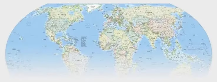
The UN promotes more precise cartography: The end of geographical distortions
The United Nations General Assembly has taken a historic step toward a geographical representation that is more faithful to reality. With an overwhelming approval of 164 votes in favor on September 4th, the international body seeks to correct the disproportionate perception that traditional maps have projected for centuries regarding the true size of the continents, with a particular focus on Africa.
The initiative, led by various African nations, was not without controversy. The United States firmly opposed the resolution, labeling it an ideologically driven project, while countries such as Ukraine, Georgia, Estonia, Lithuania, Moldova, and Serbia opted to abstain.
Why change the map we know?
The focus of the debate centers on the Mercator projection, a cartographic system developed in 1569. While it was a revolutionary tool for maritime navigation by allowing for the plotting of constant courses, its application in the modern world has generated significant visual distortion: territories far from the equator appear notably larger than they are in reality.
Maps play an important role in the way societies understand the world, by influencing education and collective perceptions.
Robert Dussey, Minister of Foreign Affairs of Togo
To illustrate this disparity, one only needs to look at Greenland on conventional maps, where it appears to have a similar magnitude to that of Africa. In real geographical terms, the African continent is approximately 14 times larger than the aforementioned island, a difference that the UN seeks to make visible through the adoption of new standards.
Towards a new educational and technological standard
The UN resolution establishes a series of recommendations for governments, educational institutions, and tech giants:
- Adopt equal-area projections, such as the Equal Earth model, which ensures a faithful representation of continental dimensions.
- Implement educational programs that explain the technical limitations of transferring a three-dimensional sphere onto a two-dimensional plane.
- Encourage the use of accurate cartography in digital media and official documents to avoid biases in global perception.
With this change, the international organization aims to reduce the distortions that have shaped the world view for centuries, promoting a cartography that more accurately reflects the geographical reality of our planet.


